The trail through Skookumchuck Narrows Provincial Park is one of the most well-known and spectacular hikes on the Sunshine Coast. The 4-kilometre forested path (8 kilometres round-trip) is wide and forgiving, and not too physically demanding. There are a few rolling hills and the occasional root and rock to clamber over. The trail passes through second-growth forest, with interpretive signs along the way communicating the logging history of the area. At the end of the trail, hikers are rewarded with views of one of the largest tidal flows in the world. In fact, Skookumchuck is a Chinook Jargon word meaning “strong water.”

Did you know? The Sechelt Rapids are the main attraction on this hike. They are located in Skookumchuck Narrows, between Jervis Inlet and Sechelt Inlet. Twice daily, nature puts on a show as the tide changes and the flow of saltwater changes, reversing the direction and power of the incredibly turbulent Sechelt Rapids. The difference in water levels between one side of the rapids and the other sometimes exceeds 9 feet in height, with 200 billion gallons of water flowing through! The Sechelt Rapids are famous for their spectacular whirlpools and, for extreme kayakers and divers, “The Skook” is one of the great white-water wonders of the world, attracting thrill-seekers from across the globe.

Sechelt Rapids, Skookumchuck Narrows Provincial Park
Watching the tidal change in Skookumchuck Narrows Provincial Park. Photo: Sunshine Coast Tourism/Errin Casano

Location & Trail Notes

Skookumchuck Narrows Provincial Park is located just off Highway 101 in Egmont, not far from the Earls Cove ferry terminal. Turn onto Egmont Road (you’ll see the signs for “Home of the Skookumchuck Narrows”) and follow Egmont Road for approximately 6 kilometres until you see the signs for Skookumchuck Narrows Provincial Park on your right. There is a long row of parking along Egmont Road but it can get quite busy in the summer, so plan accordingly. Then just follow the signs from the parking area along a local traffic-only road (about 10-15 minutes) to the trail that is well-marked.

Tip: You’ll pass by the Skookumchuck Bakery & Cafe (open seasonally). Stop by before or after your hike for a treat!

Although many people hike this trail to see the Sechelt Rapids, there are plenty of beautiful West Coast rainforest views along the way. You’ll also pass by Brown Lake before coming to a trail junction where you can choose to continue on to two different viewpoints: Roland Point or North Point.

Skookumchuck Trail
Hiking through Skookumchuck Narrows Provincial Park. Photo: Sunshine Coast Tourism/Annie Wise

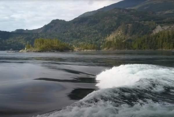
The rapids are most spectacular at certain times of the day. The best waves are on the XL flood current and viewed from Roland Point. On the ebb current, head for North Point, which offers the best viewing from an open rocky outcrop (with fencing for safety) to see the gurgling whirlpools. Click here to download the best viewing times schedule.

Watch for marine life along the shores—a variety of sea stars, urchins, crabs, sea cucumbers, sea lions, and other creatures call Skookumchuck Narrows their home.
 

Safety Notice

While incredible, the rapids get their name for a reason. Use caution when near the water, especially with small children and pets who should be under constant supervision (also note that pets should be leashed at all times on the trail and at the viewpoints). The waters are extremely dangerous and should only be tackled by highly experienced paddlers, divers, and boaters. 
 

Trail Map, Amenities & More Information

Visit the BC Parks website for a trail map, park activity information, and more. There are toilets located in two spots: near the parking area, and just past the junction on the Roland Point trail. 

Looking for information about how to hike safely and responsibly? Check out the following resources: